Canadian Hydrographic Service (CHS)
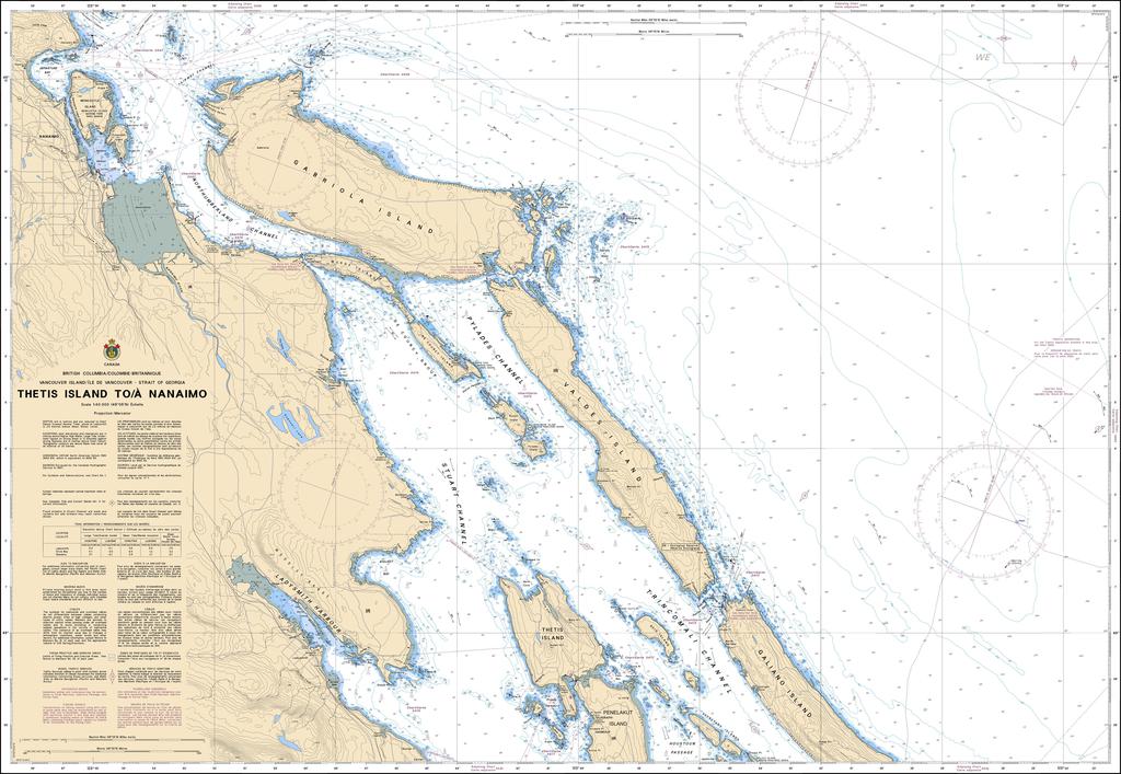
Canadian Nautical Chart #3443 - Thetis Island to Nanaimo
Canadian Nautical Chart #3443 - Thetis Island to Nanaimo
Couldn't load pickup availability
Share
Chart a course through one of British Columbia's most scenic cruising grounds with Canadian Nautical Chart #3443 – Thetis Island to Nanaimo! Whether you're planning your next voyage or creating a coastal-inspired display, this detailed chart is equally at home on the water or proudly framed on the wall.
Covering the waters around Thetis Island, Valdes Island, Gabriola Island, Nanaimo, Ladysmith Harbour, Stuart Channel, Trincomali Channel, and Silva Bay, this official Canadian nautical chart is an invaluable companion for boaters, sailors, kayakers, and maritime enthusiasts. The region has a rich seafaring history, with Nanaimo evolving from a Hudson's Bay Company trading outpost into one of Vancouver Island's most important ports during the 1800s.
Printed at an impressive 48" x 36" with a detailed 1:40,000 scale, this chart reveals intricate coastal features, navigation information, and shoreline detail. Whether you're plotting future adventures, remembering unforgettable cruises, or decorating a home, office, cabin, or yacht, this beautiful nautical chart captures the timeless spirit of British Columbia's spectacular Gulf Islands coastline.
SKU: SKU:CHY3443
View full details