Canadian Hydrographic Service (CHS)
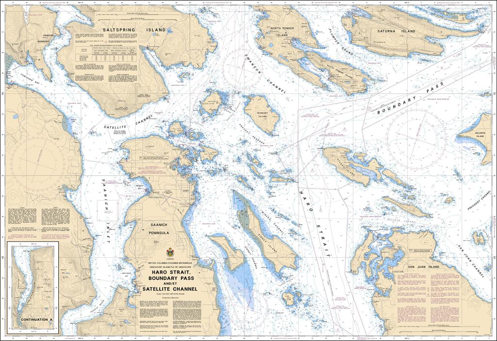
Canadian Nautical Chart #3441 - Haro Strait, Boundary Pass & Sat Ch
Canadian Nautical Chart #3441 - Haro Strait, Boundary Pass & Sat Ch
Couldn't load pickup availability
Share
Turn every voyage into an adventure with Canadian Nautical Chart #3441! Whether you're plotting your next cruise or creating a striking nautical display, this detailed chart brings the spectacular Salish Sea to life.
Covering the scenic waters of Haro Strait, Boundary Pass, and Satellite Channel, this Canadian Nautical Chart guides you through one of the Pacific Northwest's most captivating cruising regions. Explore the waters surrounding Sidney and the Sannich Peninsula, North Pender Island, South Pender Island, Saturna Island, and southern Saltspring Island, with detailed soundings, navigation aids, shoreline features, and channels that have welcomed mariners for generations. At a scale of 1:40,000, every detail is presented with exceptional clarity across its impressive 49" x 36" format.
These waterways played a pivotal role during the famous Pig War of 1859, a peaceful international boundary dispute that ultimately helped define the modern U.S.-Canada border. Today, they're celebrated for world-class boating, whale watching, and unforgettable island-hopping adventures.
Perfect for active navigators, history enthusiasts, or anyone who loves coastal décor, this beautiful chart is equally at home aboard your vessel, in your office, or displayed as timeless wall art celebrating the rich maritime heritage of the Pacific Northwest.
SKU: SKU:CHY3441
View full details