National Geographic
Alpine Lakes Wilderness Area Map
Alpine Lakes Wilderness Area Map
Couldn't load pickup availability
Share
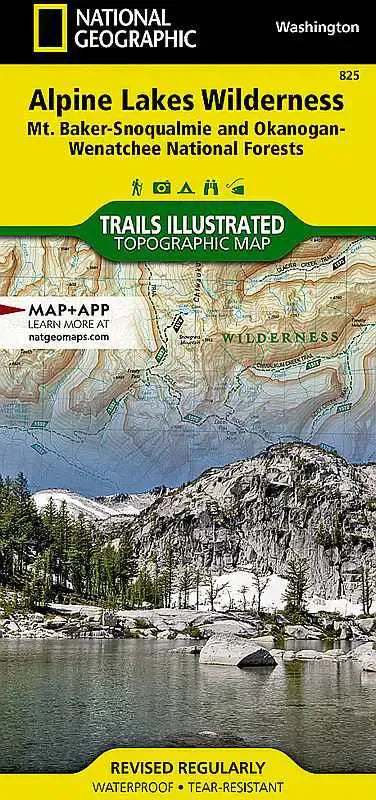
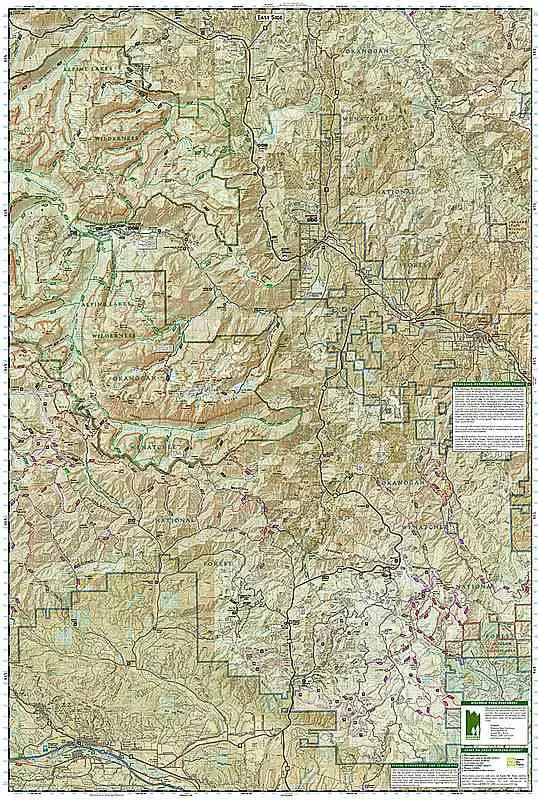
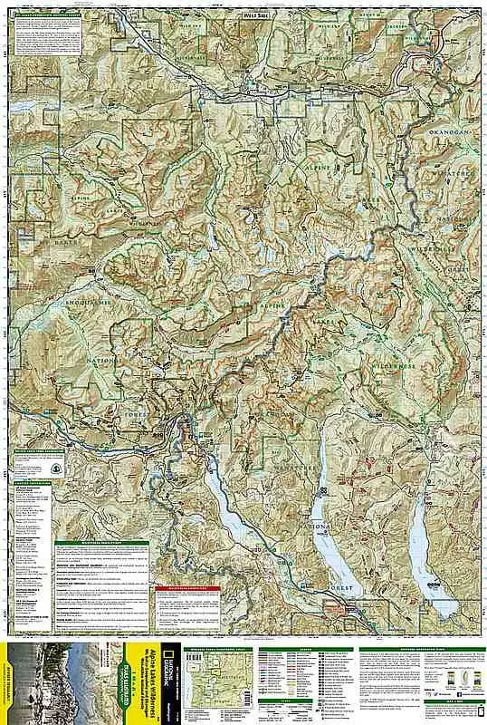
The National Geographic Trails Illustrated Topographic Map #825: Alpine Lakes Wilderness is the ultimate resource for outdoor adventurers exploring the rugged beauty of Washington’s Central Cascades. This expertly crafted map provides detailed, up-to-date topographic information, making it an essential companion for hiking, camping, fishing, and backpacking enthusiasts.
Covering the Alpine Lakes Wilderness in vivid detail, this map highlights a stunning network of trails that weave through pristine alpine meadows, dense forests, and sparkling high-altitude lakes. Key features such as peaks, ridgelines, and elevations are clearly marked, including iconic destinations like the Enchantments, Snow Lake, and Mount Stuart. The map also includes details about access points, trail mileages, and backcountry campsites, helping you plan everything from day hikes to multi-day treks.
Printed on durable, waterproof, and tear-resistant material, this map is built to withstand harsh wilderness conditions. Its easy-to-read design incorporates shading, contour lines, and vegetation overlays, ensuring accurate navigation through the varied terrain of the Cascades. Additionally, the map highlights important information such as wilderness boundaries, regulations, and safety tips to help you enjoy a responsible outdoor experience.
Whether you’re chasing panoramic views from mountain summits, exploring hidden lakes, or marveling at the wildflower-strewn trails, the Trails Illustrated Topographic Map #825 ensures you’ll never lose your way. Take your Alpine Lakes Wilderness adventure to the next level with this trusted and reliable guide in hand.