National Geographic
Alaska's Inside Passage Map
Alaska's Inside Passage Map
Couldn't load pickup availability
Share
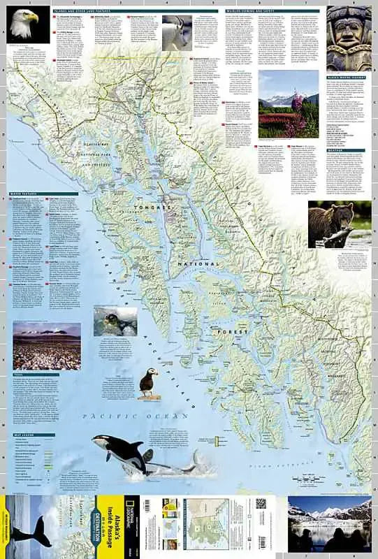
Alaska's Inside Passage map covers from Prince Rupert to Skagway including Glacier Bay and Tongass National Forest.
The front side of Alaska’s Inside Passage has a map of the region from the northern reaches of Glacier Bay National Park and Preserve south to Prince of Wales Island. Information about the islands and other land features, wildlife viewing and safety, the weather, the tides and more is included
The reverse side of the map provides invaluable content for travelers with extensive descriptions of points of interest and information about tours, outfitters, visitor associations, lodging, the geology of the region, and local indigenous cultures. A National Parks chart includes services offered and contact information for each park, and an additional map of the entire state of Alaska provides context for the region.