1
/
of
2
National Geographic
Acadia National Park Trails Illustrated Map #212
Acadia National Park Trails Illustrated Map #212
Regular price
$14.95 USD
Regular price
Sale price
$14.95 USD
Unit price
/
per
Couldn't load pickup availability
Share
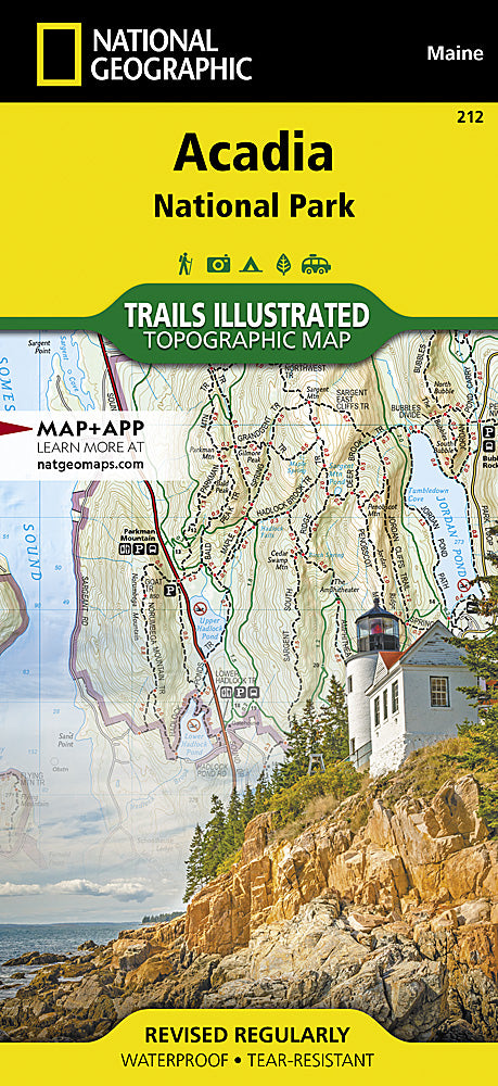
Adventure is just a map away with National Geographic’s Acadia National Park Trails Illustrated Topographic Map #212. Whether you're hiking the rugged coastline, cycling the historic carriage roads, or kayaking the sparkling inlets, this waterproof, tear-resistant map has you covered.
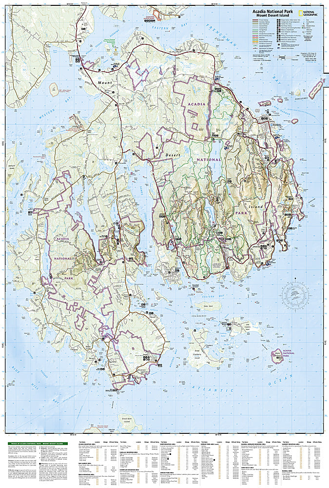
Discover over 120 miles of trails with detailed charts that break down distances, difficulty levels, and scenic highlights across Mount Desert Island, Schoodic Peninsula, and Isle au Haut. Looking for waterfalls? Coastal views? Quiet forest paths? Let the map guide your perfect day. Insets highlight ferry routes and visitor access points, while clear topography and elevation contours help you stay oriented. You’ll also find handy info on boat ramps, lighthouses, museums, swimming areas, and more.
Developed in collaboration with the National Park Service, this map is more than a trail guide—it’s your ticket to exploring one of America’s most spectacular national parks with confidence, curiosity, and a sense of wonder.