WoodChart
Columbia River Mouth 3D Nautical Wood Chart
Columbia River Mouth 3D Nautical Wood Chart
Couldn't load pickup availability
Share
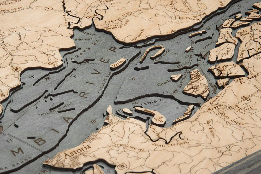
Capture the raw beauty and maritime heritage of the Pacific Northwest with this Columbia River Mouth 3D Nautical Wood Chart. Where the mighty Columbia River meets the vast Pacific, this iconic stretch of coastline marks the boundary between Washington and Oregon and serves as one of the most historically significant waterways in the United States. Stretching over 1,200 miles from the Rocky Mountains to the sea, the Columbia River has long been a vital trade route, fishing ground, and gateway to the West. Its powerful currents and shifting sandbars earned the river bar the nickname “Graveyard of the Pacific,” a testament to the region’s dramatic coastal conditions and rich nautical lore.
Columbia River Mouth Wood Chart points of interest include: Ark National Wildlife Refuge, Astoria, Fort Columbia State Park, and the Pacific Ocean. Astoria, founded in 1811, is the oldest American settlement west of the Rocky Mountains and played a pivotal role in early fur trading and maritime commerce. Across the river, Fort Columbia State Park preserves remnants of a Civil War–era coastal defense system built to protect this strategic entrance. The expansive Pacific Ocean forms the chart’s western edge, where river and tide collide in a constantly shifting dance of freshwater and saltwater.
Columbia River Mouth Nautical Wood Chart color options: Choose a Dark Brown Frame with Greenish Blue Water for a classic maritime feel reminiscent of evergreen forests and deep coastal channels, or select a Rustic Gray Frame with Grayish Blue Water for a weathered, driftwood-inspired look that echoes the misty shoreline and rugged cliffs of the Pacific Northwest.
Columbia River Mouth 3D Nautical Wood Chart production process: Measuring 31" x 13.5", this handcrafted piece begins with detailed bathymetric data to ensure geographic accuracy. An artist laser cuts premium birch wood into layered sections representing depth contours, then carefully assembles and bonds them to create a dimensional seafloor effect. The water is individually hand-stained, while place names, roads, landmarks, and depth markings are precisely engraved into the surface. Each chart is completed with a custom wood frame and protected beneath durable acrylic glass, resulting in a striking, heirloom-quality coastal display.
SKU: SKU:MINCRM
View full details